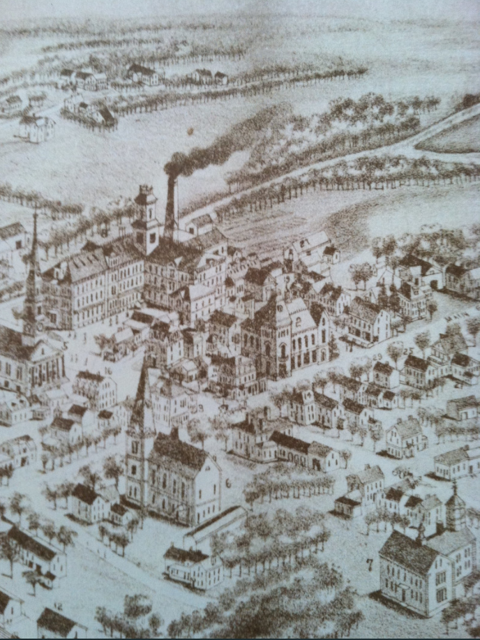
This 1887 aerial view of the downtown is another one of the Medfield Historical Society’s on-line maps.
The only familiar buildings to me are the Ord Building, the Unitarian Church, and the town house (and only sort of for the town house – it is in the right place).

Check out this map from around the same time. https://www.loc.gov/resource/g3764mm.g037831933/?sp=2
LikeLike
A bit later, actually. The map says 1933.
LikeLike
those are really interesting maps, and I am fascinated that a fire insurance company was the one with the reason/need to make them.
LikeLike